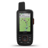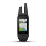
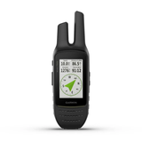


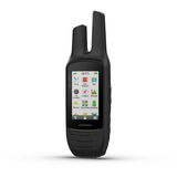


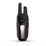

Garmin Rino 750t Handheld 2-Way Radio/GPS Navigator With Touchscreen And TOPO Mapping
Combining map-guided trail navigation with two-way radio communication, the Rino 750t handheld brings a whole new level of confidence to your outdoor adventures. These models feature unique position reporting capabilities that let you send your exact location to other Rino users so they can see it on their map displays.
- 5-watt GMRS two-way radio offers extended range, up to 20 miles; communicate by voice or unit-to-unit text messaging
- High-sensitivity GPS and GLONASS satellite reception; tracks in more challenging environments than GPS alone
- Position reporting feature shows locations of other Rino users on the same channel
- 3 in. sunlight-readable touchscreen with dual orientation (landscape or portrait view)
- Dual battery system provides up to 14 hours between charges on lithium-ion pack or up to 18 hours with optional AA batteries (not included)
- Rino 750t handhelds add preloaded TOPO U.S. 100K maps
The Rino 750t model features powerful 5-watt GMRS two-way radios that let you easily stay in touch with your fellow hunters, hikers or explorers in the field. You can also maintain nonverbal contact by exchanging unit-to-unit text messages with other Rino users in your area.
The Rino 750t handheld comes with a worldwide shaded relief basemap. With a wide array of detailed topographic, marine and road maps available, it’s easy to install additional mapping products. Just use the unit’s microSD card slot to load the compatible mapping options you want. Or you can use Garmin's free Custom Maps software to transform paper and electronic maps into downloadable maps for your device.
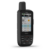
With support for active weather forecasts and animated radar tracking, the Rino 750t give you a vital edge in weather awareness1. Get real-time conditions, forecasts and alerts (in areas with coverage) directly on your handheld display when the Rino handheld is paired with your compatible smartphone and the Garmin Connect Mobile app. For added situational awareness, a built-in NOAA weather radio supports Specific Area Message Encoding, which allows you to see National Weather Service warnings and watches displayed county by county on the map screen.
Syncing your Rino 700 series handhelds with a compatible headset enabled with BLUETOOTH connectivity enhances your radio communications — even under adverse weather or windy conditions.
By syncing your device with a compatible smartphone, you can also receive smart notifications (calls, texts, emails and more) right on your display so you can stay focused on the trail ahead while staying connected with friends and family back home. For added flexibility, you can even customize your Rino handheld’s display with free downloads of apps, widgets and data fields from Garmin's Connect IQ online store.
Durable and water-rated to IPX7, the Rino 700 series is built to keep you in touch and on track, no matter what the elements throw at you. Each device features a vivid, dual-orientation, 3 in. color touchscreen that’s glove-friendly and easy to read, even in bright sunlight. And a dual battery system lets you use the included rechargeable lithium-ion power pack or AA battery pack (sold separately).
In the Box
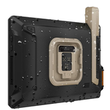
- Rino 750t
- Lithium-ion battery pack
- USB cable
- AC charger
- Carabiner clip
- Documentation
Features
- Dimensions: 2.6 in. x 7.9 in. x 1.6 in.
- Weight: 12.3 oz. with battery pack
- Water Rating: IPX7
- Touchscreen: Yes
- Display Type: 3 in. transflective, 65k color TFT
- Display Size: 1.53 in. x 2.55 in.; 3 in. diagonal
- Display Resolution: 240 x 400 pixels
- Battery Type: Removable, rechargeable lithium-ion battery pack; AA battery pack (not included)
- Battery Life: Up to 14 hours (up to 18 hours with optional AA battery pack at 2 watts)
- Memory/History: 4.5 GB (user space varies based on included mapping)
- Interface: High speed mini USB and NMEA 0183 compatible
- Maps & Memory
- Ability to Add Maps
- Basemap
- Includes Detailed Hydrographic Features
- Coastlines
- Lake/River Shorelines
- Wetlands
- Perennial Streams
- Seasonal Streams
- Includes Searchable Points of Interests
- Parks
- Campgrounds
- Scenic Lookouts
- Picnic Sites
- Displays Wilderness Areas
- National Parks
- State Parks
- Local Parks
- Forests
- Preloaded Maps: TOPO 100k U.S.; not routable
- Automatic Routing (Turn by turn routing on roads) for Outdoor Activities: Yes (with optional mapping for detailed roads)
- Map Segments: 15,000
- External Memory Storage: Yes (32 GB max microSD card)
- Waypoints/Favorites/Locations: 10,000
- Tracks: 250
- Navigation Track Log: 20,000 points, 200 saved tracks
- Navigation Routes: 250, 250 points per route: 50 points auto routing
- Sensors:
- GPS
- Glonass
- Barometric Altimeter
- High-Sensitivity Receiver
- GPS Compass (While moving)
- Compass: Yes (Tilt-compensated 3-axis)
- Daily Smart Features
- Connect IQ (Downloadable watch faces, data fields, and apps)
- Smart Notifications on Handheld
- Weather Forecasts
- Weather
- VIRB Remote
- Pairs with Garmin Connect Mobile
- Safety and Tracking Features
- Livetrack
- Tactical Features
- XERO Locations
- Outdoor Recreation
- Geocaching-Friendly: Yes (Geocache Live)
- Custom Maps Compatible: Yes (500 custom map tiles)
- Point-to-Point Navigation
- Area Calculation
- Fish Forecast
- Sun and Moon Information
- Picture Viewer
- Radio Features
- VOX (Voice Activation)
- Location Reporting (Send and receive GPS positions)
- Vibration Alert
- Frequency Band: GMRS
- Channels: 22
- Squelch Codes: 38 (CTCSS); 83 (DCS)
- Range: Up to 20 miles over GMRS
- Contacts: 50 contacts with 2,000 track points each
- Sonar Features
- Transmit Power: 5.0 watts, GMRS
- Networking & Connections
- Wireless Connectivity: Bluetooth, ANT+